
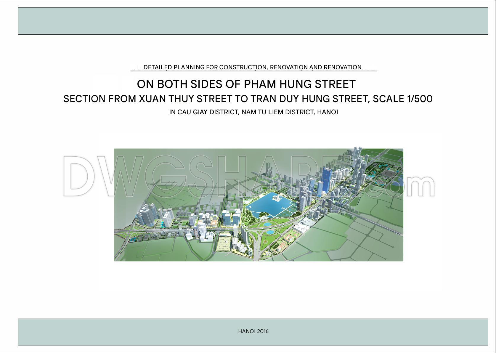
154. Download CAD Drawing – Detailed Planning Project on Both Sides of Ring Road 3
- File format: .DWG; .JPG
- Size: 133 MB
In addition, you can download the complete project documentation here.
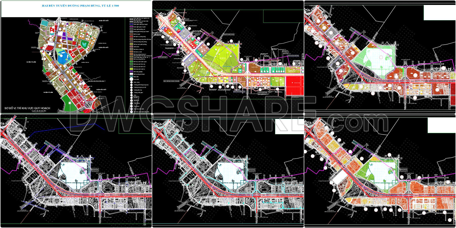
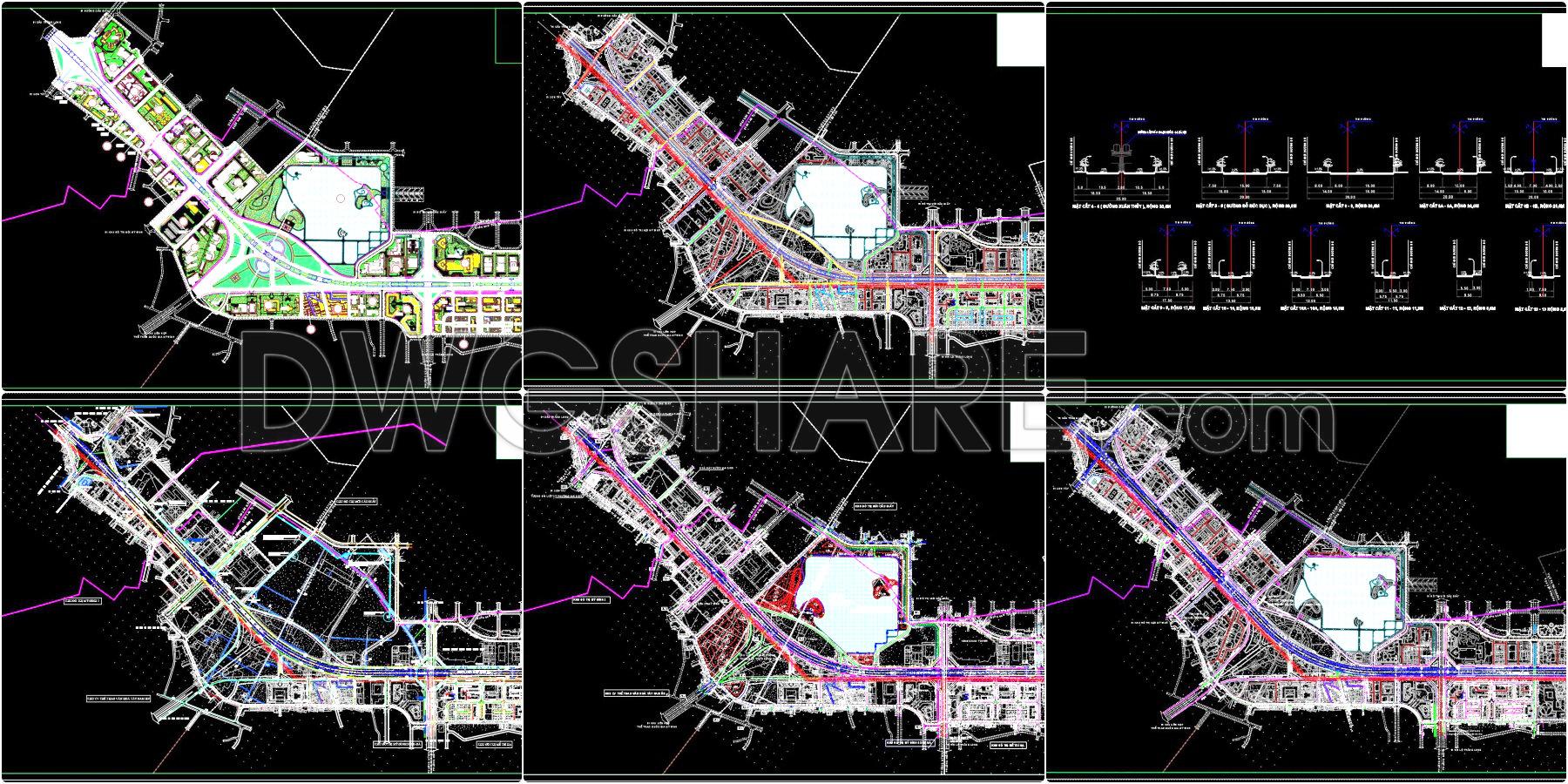
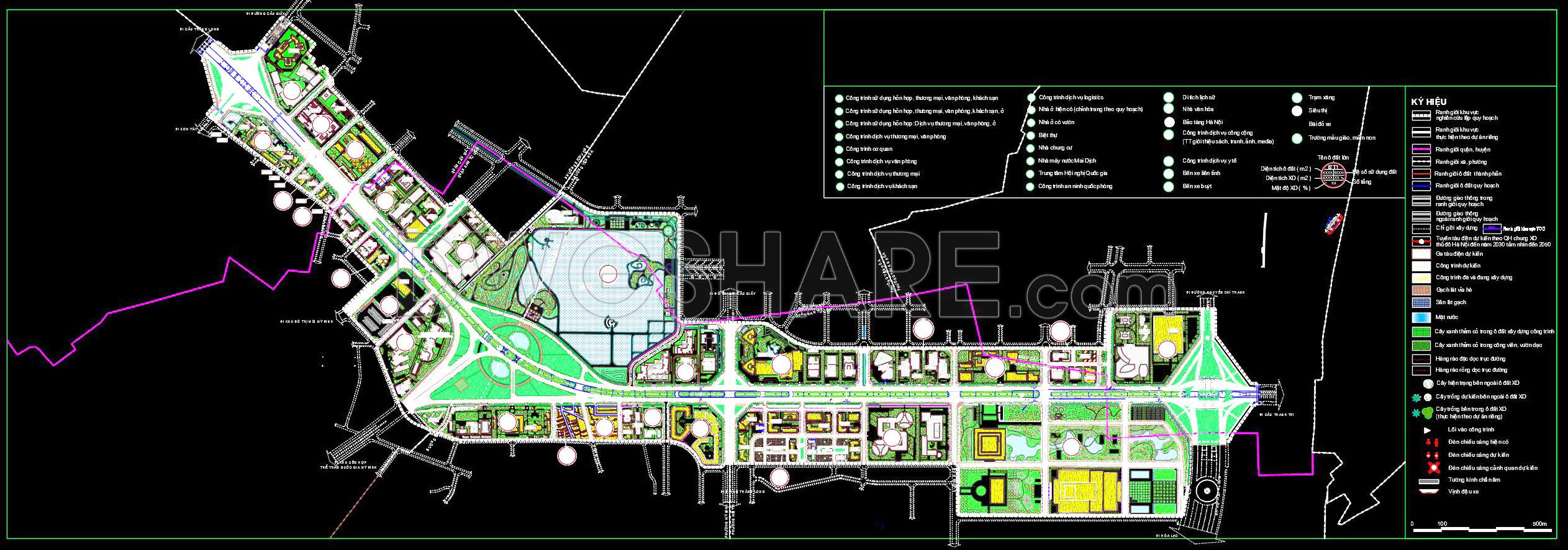
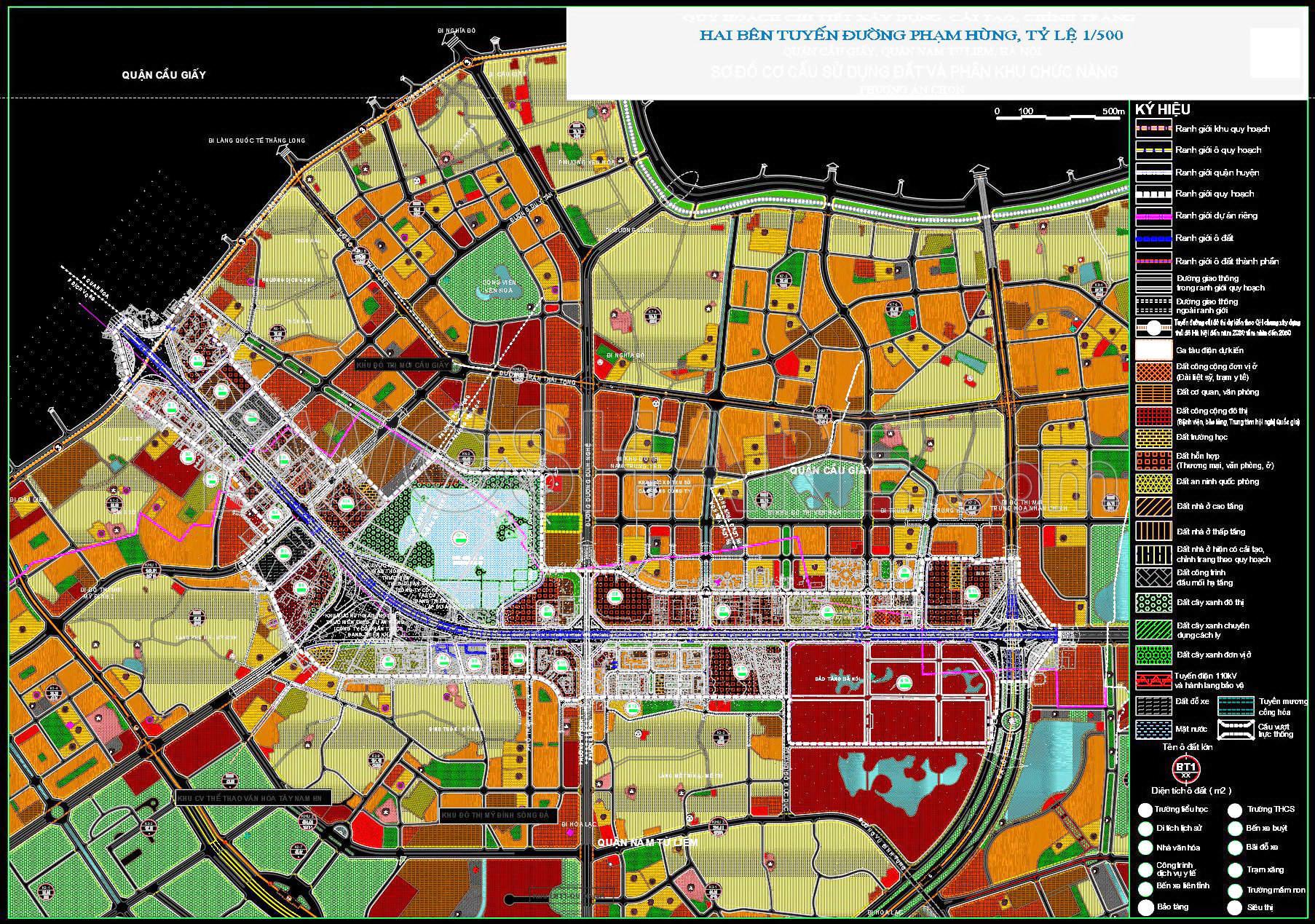
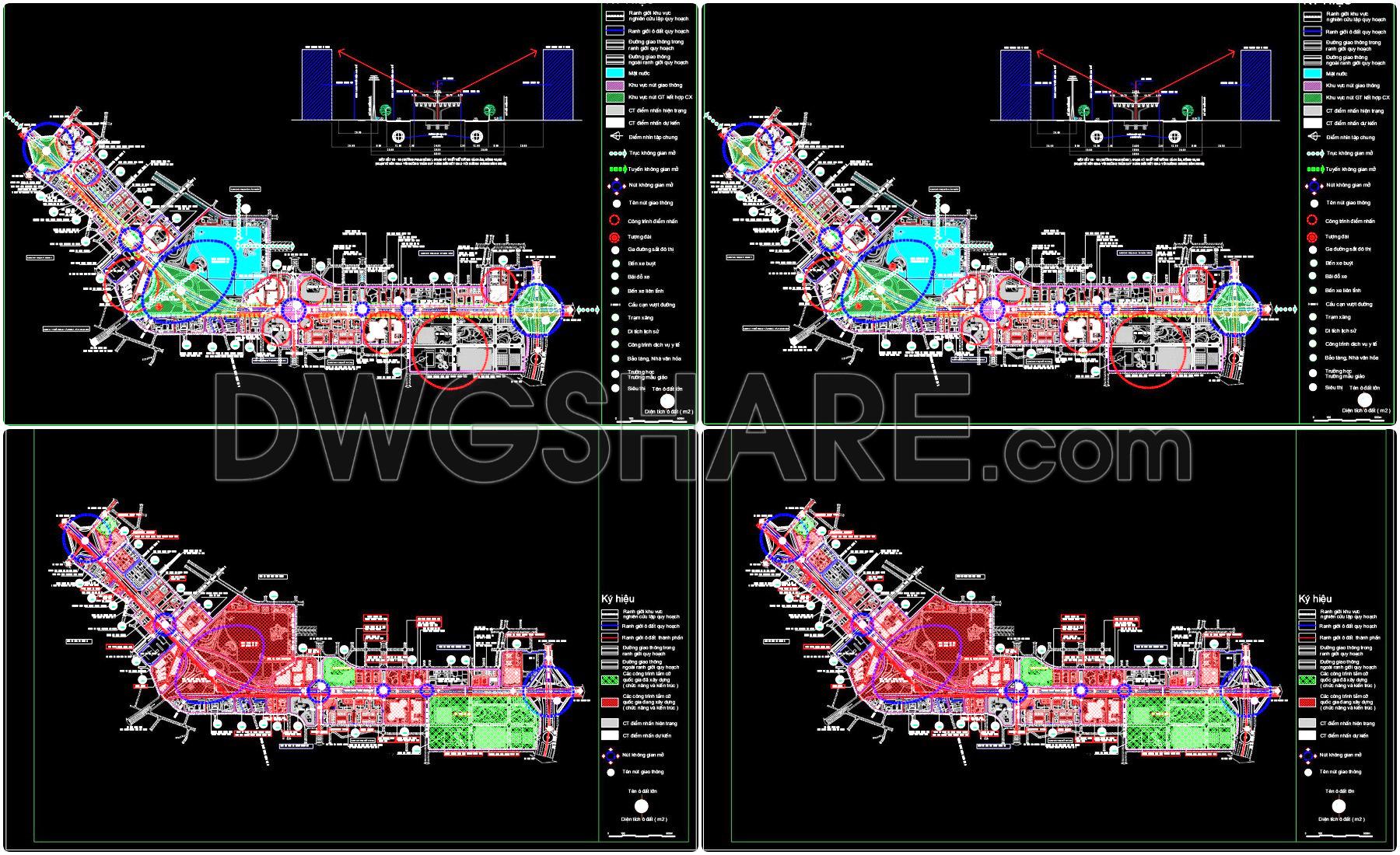
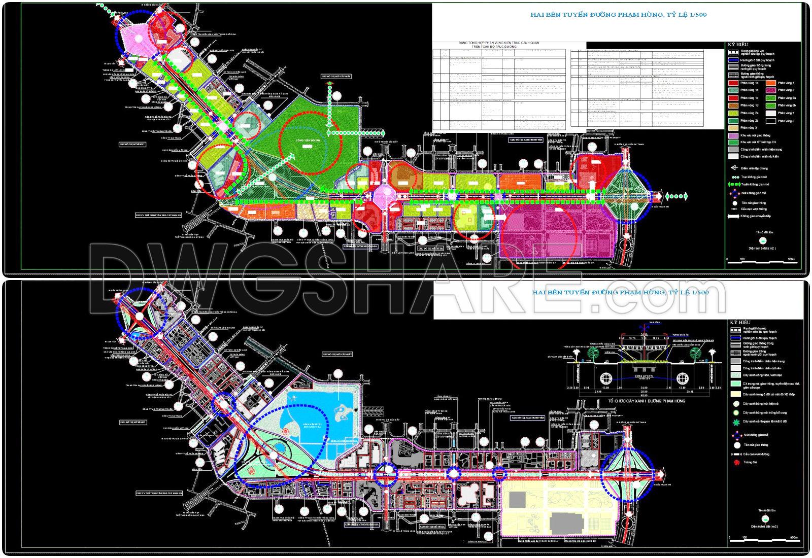
- Overall planning boundary: Outlines the scope of the planning area.
- District and ward boundaries: Defines administrative divisions within the planning zone.
- Planning block and land lot boundaries: Identifies specific blocks and plots for functional zoning.
- Transportation system: Includes main roads, internal roads, roundabouts, underpasses, and overpasses.
- Public transit routes: Covers bus lines, rapid bus routes, subways, urban railways, and national railways.
- Land use zoning:
– High-rise and low-rise residential areas, resettlement zones
– Public facilities (education, healthcare, sports, administration)– Mixed-use zones (commercial, service, office, residential)
– Green spaces: thematic, buffer, residential, landscape
– Religious, cultural, and heritage sites
– Technical infrastructure and utility hubs - Water bodies and natural landscapes: Lakes, canals, riverside parks
- Parking lots and gas stations: Locations for traffic and urban amenities
- Planning parameters: Land area, building height, construction density, land use coefficient
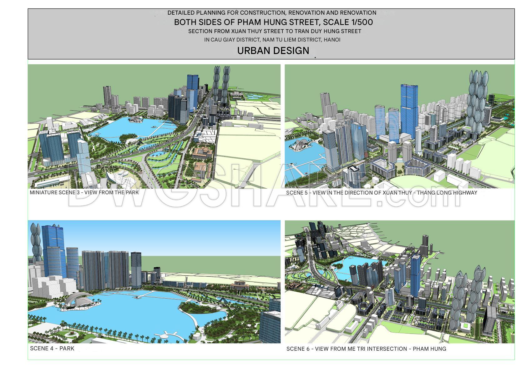
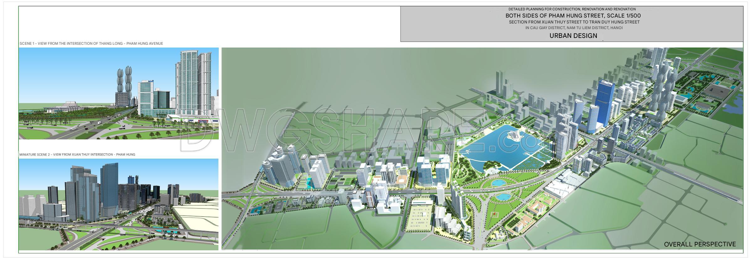
- 3D perspective drawings: Views from major intersections like Xuan Thuy, Me Tri, Thang Long – Pham Hung, showcasing a modern urban space

Be the first to review “154. Download CAD Drawing – Detailed Planning Project on Both Sides of Ring Road 3”
Related products
-80%

Original price was: $10.0.$2.0Current price is: $2.0.
-80%

Original price was: $10.0.$2.0Current price is: $2.0.
-82%

Original price was: $11.0.$2.0Current price is: $2.0.
-71%

Original price was: $10.0.$2.9Current price is: $2.9.
-69%

Original price was: $13.0.$4.0Current price is: $4.0.
-80%

Original price was: $10.0.$2.0Current price is: $2.0.


-100%

Original price was: $10.0.$0.0Current price is: $0.0.
Reviews
There are no reviews yet.