


157. Download Detailed Traffic Planning Map CAD Drawing
- File format: .DWG
- Size: 2.69 MB
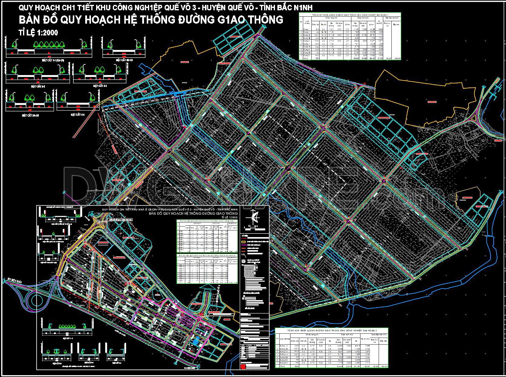
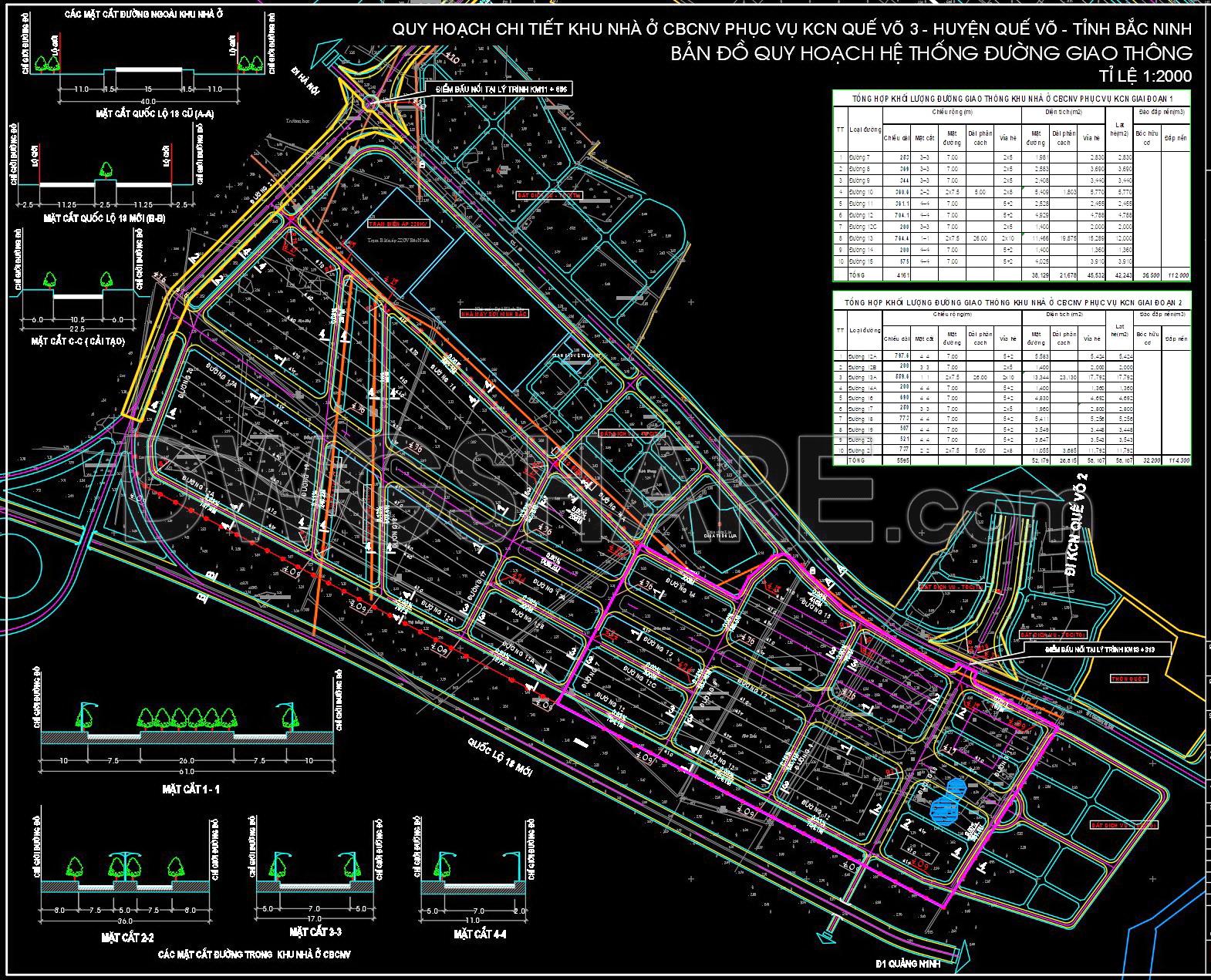
The CAD drawing presents the detailed traffic planning of Que Vo 3 Industrial Park at a 1/2000 scale, developed based on a primary road framework combined with an internal grid network. The documentation includes the overall layout plan, typical road cross-sections, grade-separated intersections, and quantity summary tables, ensuring synchronized technical infrastructure management. Main roads are clearly defined with construction setback lines, carriageway widths, medians, sidewalks, and traffic safety corridors. The traffic organization strategy guarantees efficient connectivity to national highways and adjacent functional zones, while optimizing turning radii for container trucks and heavy-duty vehicles. This drawing set is suitable for planning approval, appraisal processes, and implementation of technical infrastructure projects within industrial parks, aligned with sustainable development principles.
Be the first to review “157. Download Detailed Traffic Planning Map CAD Drawing”
Related products


Reviews
There are no reviews yet.